gispoint.com
Hi! I'm
Ton
I am an expert in geography research & development
Impressive mapping of geographically location-bound information
Connect
More than spatial visualization and data analysis
Custom Geo-information facilities and data organization
Ton Brouwer from Gispoint.com is the GIS expert with a lot of specialist knowledge and gives more than your organization needs. More than the geographical information you have been asked for.
I am developing geographic information systems that will provide you with more qualitative and analytical insight with impressive digital three-dimensional maps in relationships between data. Like infrastructure, energy supply and security, amongst other things. And structure in your organization.
Data from real and virtual objects with a spatial component combined and accurately mapped in two or three dimensions
Our services
The 6 core values of Gispoint.com
Explore at lighting speed
Quickly inventory problems, product and organization. Exploring and deepening your domain, which I quickly 'own'
Abstract thinking ability
Clear link between location and information by reducing the problem to the essence, and discover the steps on how to solve this
Complex Analysis
Expert knowledge of GIS software, algorithms, mathematics, complex calculation models and software development
Custom software
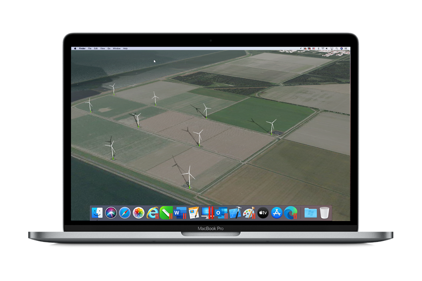
I can map data with coordinates or ... develop 'customized' software and training, so that you can map out your data yourself
Many disciplines
Broad knowledge of applications, fields of work and disciplines in which the spatial component plays an important role
Proven results
More than 20 years of experience for research institutions, companies and government. National and International
Link location and information
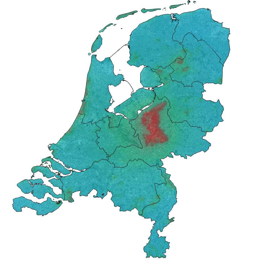
Capture, combine, analyze, integrate and present. The Strength of the geographic information system - GIS - lies in gaining insight into information about topographic objects with a geographic dimension by linking data
Map topographically bound objects
Data from real and virtual objects with a spatial component are combined and accurately mapped in two or three dimensions. This provides great insight into the effect and connections in, for example, planning traffic, environment, safety, economics and earth sciences
More qualitative and analytical insight
Better insight into maximum utilization of information sources for procedures, organization, personnel, object and datamanagement by linking data of geographic objects with coordinates.
Data organization and improvement
Bringing the problem back to its essence, seeing steps on how to solve it. Clear information. Structure in data, deployment of personnel, for effective and adequate work.
Our clients

Cooperate with Ton
Connect
Would you also like more geographic insight into data for your organization or customer? Get in touch with Ton Brouwer
Gispoint.com
Ermelo, The Netherlands